Posts

Showing posts from November, 2020
Image
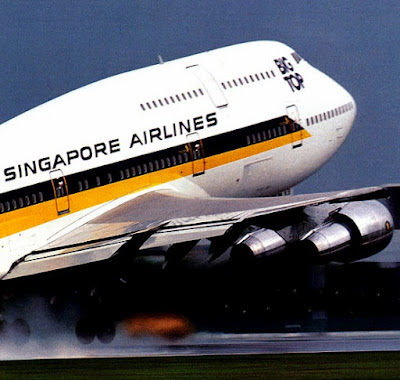
  *     *     *     *     *      Getting back to my first visit to the States, since joining SIA, we departed Honolulu on 23rd October 1987, for San Francisco – with an en route flight time of 4:54 hours.         Honolulu International (HNL) had parallel runways, Eight Left and Eight Right, for the “Heavy-Jets.”   Because of the prevailing wind from the east, Runway Eight Left was used for landings, with a length of 12,300 feet, while Eight Right was used for takeoffs, having a length of 12,000 feet.       Runway Eight Right at HNL was called the “Reef Runway”; for, in 1977, it was the first major runway to be constructed entirely offshore on a reef.   Hence we had one hell of a long taxi - taking a bridge across a lagoon - to reach its departure end.   Upon launching our 747, we were required to make a 90-degree, wild-ass right tur...
Image
                                          *     *     *     *     *      The following year though – 1988 – my Honolulu layovers vastly improved.  SIA listened to the pilots’ bitching about their lack of sleep, and moved us to the Ilikai Hotel at 1777 Ala Moana Blvd.  A five-star hotel having richly appointed rooms generally with a panorama of the yachts in the Ala Wai Boat Harbor, and a better class of clientele.  Hence no more fights or parties; allowing us poor airline pilots a decent night’s rest.           My Room – usually I got a view of the following:   The yachts in the Ala Wai Boat Harbor.   The Kahanamoku Lagoon.       In fact, dear reader, for you TV buffs, it was an Ilikai balcony where actor Jack L...
Image
                             *     *     *     *     *       Following the “Booke Seven Arrival” on our Jeppesen Plate, we departed the emerald-green garden island of Kauai.   Descending through the broken cloud layer we passed the “BOOKE” waypoint, and when we reached the “SHIGI” waypoint, Honolulu radar vectored us to intercept the ILS to Runway Eight Left (080°/260° magnetic, NE/SW).      While performing this descending instrument approach, we eventually broke out of  the clouds; allowing my first view of distant Oahu Island off our nose.  And it occurred  to me – since we were approaching the island from the northwest – this was perhaps  the identical sight the Japanese pilots had, when they attacked Pearl Harbor in 1941.      After touching down on the ...
Image
              *     *     *     *     *  Battle Flag of the Imperial Japanese Navy.       As we passed Kauai – glancing out my right side window – I discovered another, slender-shaped island.   Afterward, when I explored French Frigate Shoals’ history, I would learn the following concerning this island:         It lay 17.5 miles southwest of Kauai, was 18.6 miles in length and 6.2 miles in width.   It was also known as “The Forbidden Isle.”   This was because Elizabeth Sinclair purchased the island from the Kingdom of Hawaii in 1864; passing private ownership on to her descendants the Robinson family.   The island is generally off-limits to all, apart from relatives of the owners.   This is the Island of Niihau.       So what’s the big deal about Niihau, no doubt you’re askin...